Queensland is a state situated in northeastern Australia, and is the second-largest and third-most populous Australian state. It is bordered by the Northern Territory, South Australia and New South Wales to the west, south-west and south respectively. To the east, Queensland is bordered by the Coral Sea and the Pacific Ocean. To its north is the Torres Strait, separating the Australian mainland from Papua New Guinea.
With an area of 1,852,642 square kilometres (715,309 sq mi), Queensland is the world’s sixth-largest sub-national entity, and is larger than all but 15 countries. Due to its size, Queensland’s geographical features and climates are diverse, including tropical rainforests, rivers, coral reefs, mountain ranges and sandy beaches in its tropical and sub-tropical coastal regions, as well as deserts and savanna in the semi-arid and desert climatic regions of its interior.
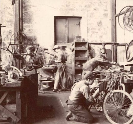
 |
| Delivering wheat to dump, Clifton, circa 1930s |
The capital and largest city in the state is Brisbane, Australia’s third-largest city. Ten of Australia’s thirty largest cities are located in Queensland, with the largest outside Brisbane being the Gold Coast, the Sunshine Coast, Townsville, Cairns and Toowoomba.
Queensland was also first inhabited by Aboriginal Australians and Torres Strait Islanders. It has the third-largest economy among Australian states, with strengths in mining, agriculture, transportation, international education, insurance and banking. Nicknamed the Sunshine State for its tropical and sub-tropical climates, Great Barrier Reef and numerous beaches, tourism is also important to the state’s economy.
These amazing photos from Queensland State Archives show what Queensland looked like during the 1930s.
 |
| Hamilton Road and Brisbane River, November 1930 |
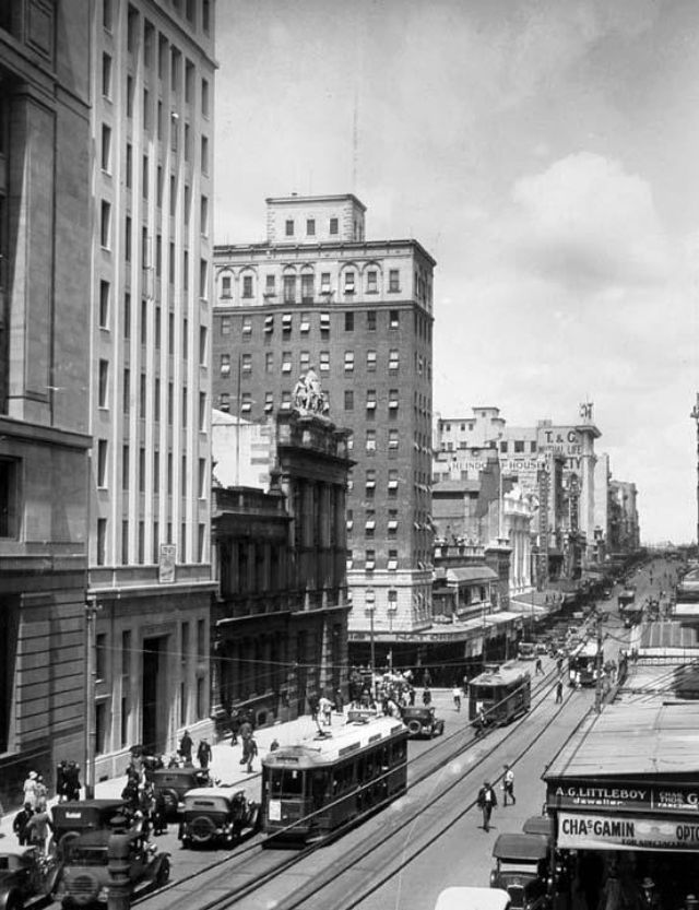 |
| Queen Street, Brisbane looking south, October 1930 |
 |
| Sailing on the Brisbane River, October 1930 |
 |
| Abbott Street, Cairns, 1931 |
 |
| Bourbong Street, Bundaberg looking west, October 1931 |
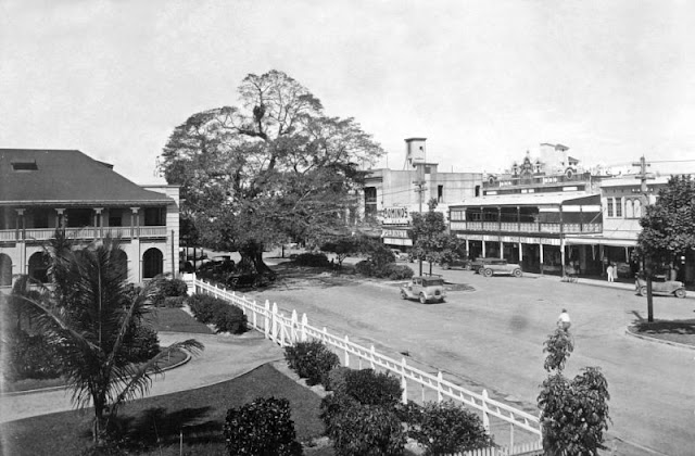
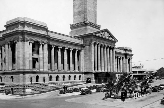 |
| Brisbane City Hall, Adelaide Street, Brisbane, January 1931 |
 |
| Mooloolaba, January 1931 |
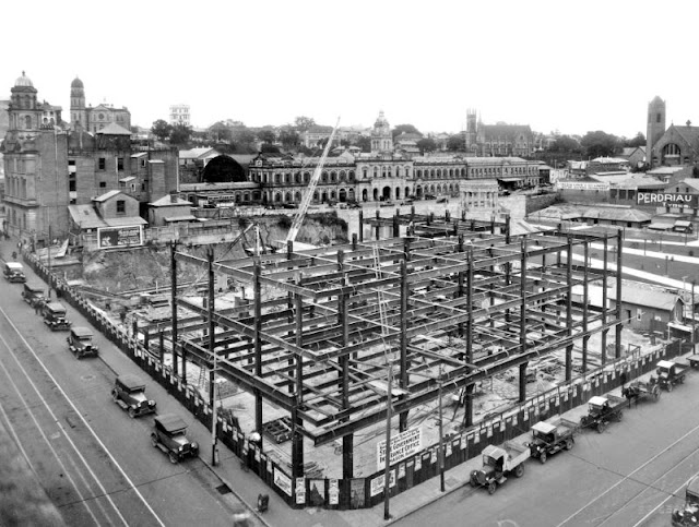 |
| Steel structure of State Government Building, Anzac Square, September 1931 |
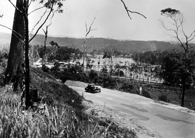
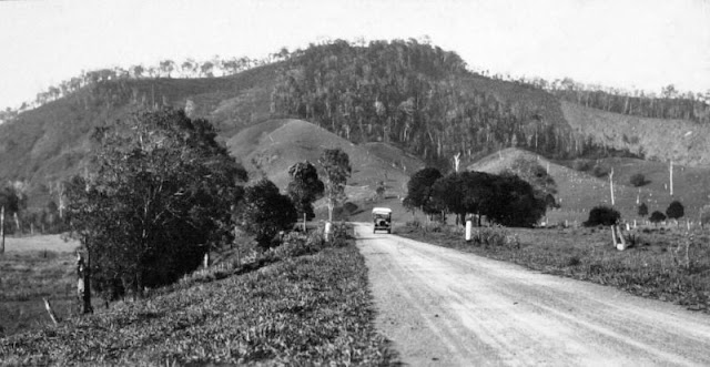 |
| The Bruce Highway at Pomona looking towards Mount Tuchekoi, 1931 |
 |
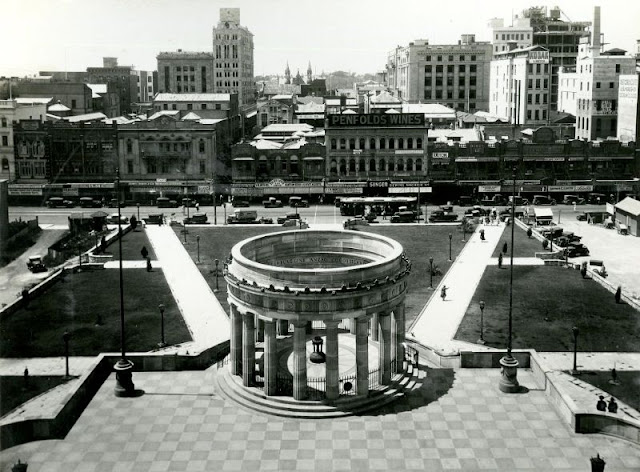
| Aerial view of the Brisbane central business district showing Victoria Bridge and the Brisbane River, 1932 |
 |
| Broadbeach, 1932 |
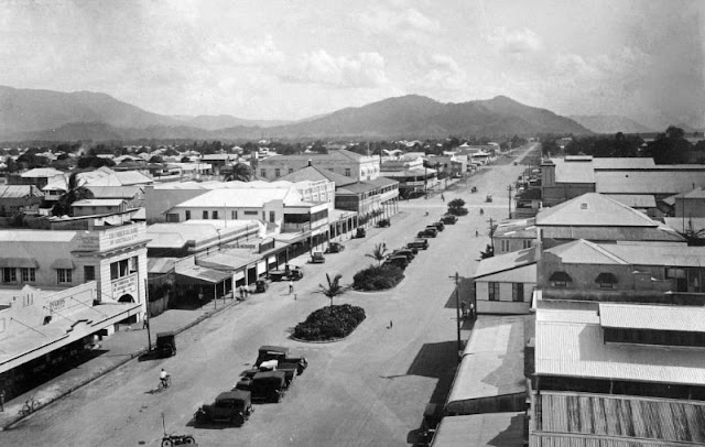
 |
| Flinders Street, Townsville, 1932 |
 |
| Jubilee Bridge, Southport, 1932 |
 |
| The Shrine, Anzac Square, Adelaide Street, Brisbane, 1932 |
 |
| Echo Point, Lamington National Park, Beaudesert Shire, September 1933 |
 |
| Flinders Street, Townsville, 1933 |
 |
| Longreach, 1933 |
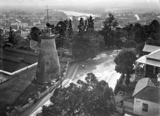 |
| Windmill Tower, Wickham Terrace, Brisbane looking west towards the William Jolly Bridge, December 1933 |
 |
| Baseline measurement in Bowen Terrace, Brisbane, June 1934 |
 |
| Looking up Currumbin Creek from Pacific Highway, Currumbin, 1934 |
 |
| Main Beach, Southport, 1934 |
 |
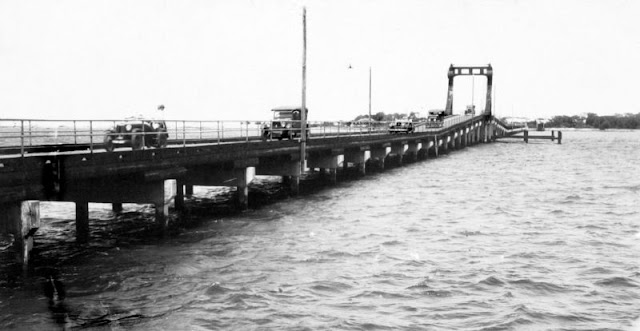
| Main Pacific Highway crossing Tallebudgera Creek, Burleigh Heads, 1934 |
 |
| Abbott Street, Cairns, 1935 |
 |
| Lake Street, Cairns, 1935 |
 |
| Lake Street, Cairns, 1935 |
 |
| Leichhardt Street, Spring Hill, Brisbane, 1936 |
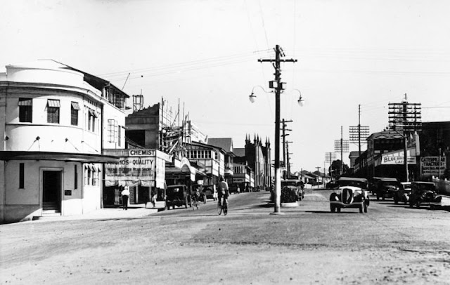 |
| Rankin Street, Innisfail, 1936 |
 |
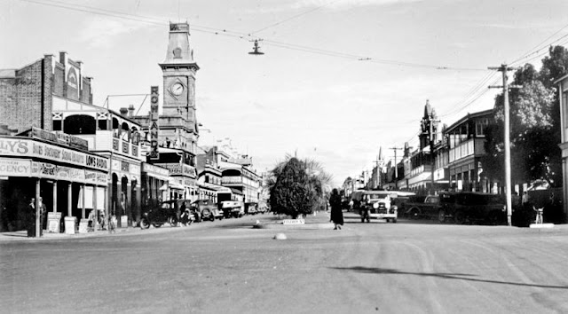
| Sydney Street, Mackay, showing the Former Mackay Town Hall, 1936 |
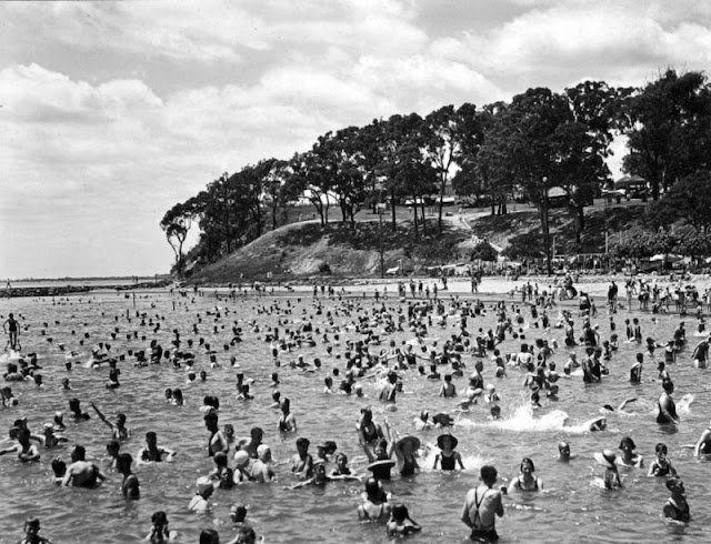 |
| Bathers and Moora Park, Sandgate, December 1937 |
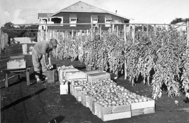 |
| Picking Tomatoes at Victoria Point, 1937 |
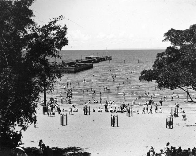 |
| The Jetty and shark-proof enclosure, Sandgate, December 1937 |
 |
| Main Street, Tully, 1938 |
 |
| Palmerin Street, Warwick, 1938 |
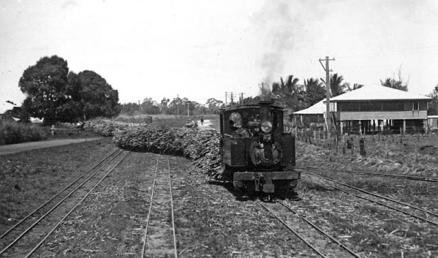 |
| Sugar cane train, Kalamia, Ayr, 1938 |
 |
| Bargara Golf Club House, near Bundaberg, circa 1930s |
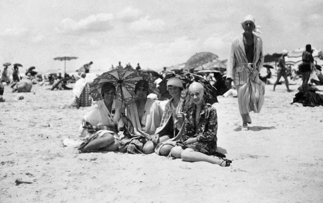
 |
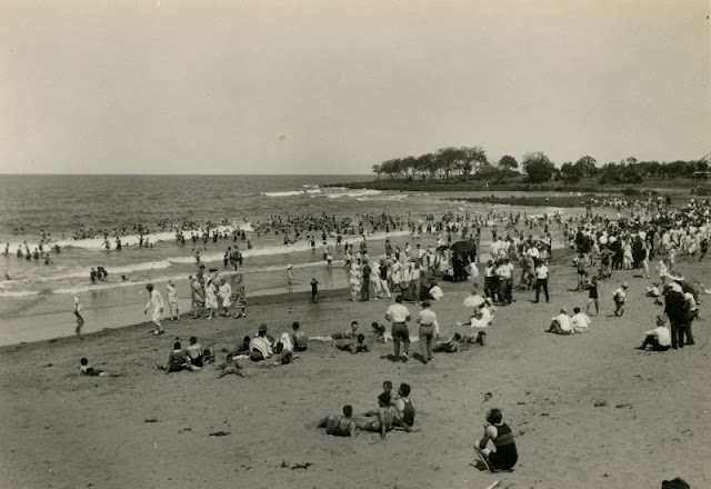
| Locals and tourists sun bathing and surfing at Main Beach in Southport, circa 1930s |
 |
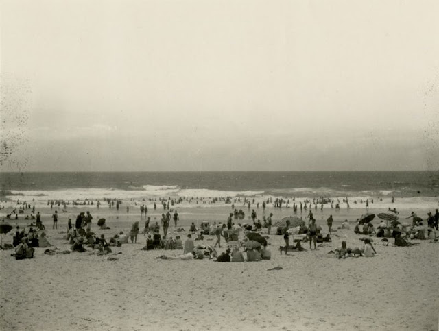
| Nielsen Park Beach, circa 1930s |
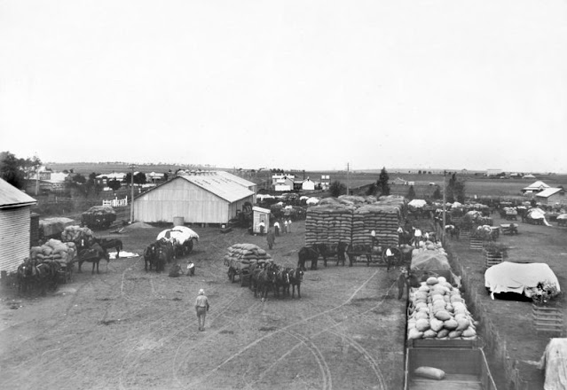
 |
| Stackbuilding at Clifton, Darling Downs, circa 1930s |
 |
| The skyscape of Brisbane City from near the Roma Street Parklands, circa 1930s |